
Anna Barnes
By Anna Barnes
Methane gas is a cornerstone in the climate change conversation. Reducing emissions is a critical part of mitigation but there is one ever-standing issue of this elusive gas: it’s invisible.
At the Society of Environmental Journalists Conference 2025, one panel focused on locating and mapping methane pools to increase targeted action against the pollutant. The panel, “Revealing the Invisible: How Remote-Sensing Satellites are Transforming Methane Accountability and Climate Action,” included Deborah Gordon, the senior principal at the Rocky Mountain Institute’s (RMI) Climate Intelligence Program.
Gordon said identifying methane has always been a struggle for scientists.
“It’s invisible, it’s odorless,” she said. “It wants to escape from any system it’s in. So here I was early on in my career, given a bucket of soapy water and a paintbrush, and I was going around to see where the pressure would form with a bubble that would come.”
Gordon said that process is still done today, but there is new technology, like remote sensing satellites , that are finally changing the game when it comes to spotting and measuring methane.
Also on the panel, Steven Hamburg, the chief scientist of the Environmental Defense Fund, said lack of data surrounding methane has made mitigation of the gas’s effects extremely difficult.
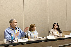
Remote sensing: Steven Hamburg and Deborah Gordon speak about their experiences in methane tracking during the 2025 Society of Environmental Journalists conference at the University of Arizona. Image: Anna Barnes
Hamburg joined a collective of over 200 scientists who began collecting as much data as they could about methane to try and bridge this data gap. After several years of research, they had collected significant information on methane pools but it was limited to the United States.
“It wasn’t global,” he said. “We had much more data in the United States than we did anywhere else in the world. Along the way, we realized we needed this whole data.”
Hamburg said they realized remote sensing tools were necessary because it was not feasible to collect worldwide data by hand.
“We needed greater precision,” he said. “We needed to see more accurately what was going on and we needed to produce a policy relevant product.”
Today, there are satellites that show concentrations of methane but do not answer critical questions, like where they are coming from or how they are changing with time. Hamburg said scientists need answers to these questions to drive change.
“Just to make it clear, methane is responsible for 30%, roughly, of the warming we currently experience,” he said. “And if we think about what we’re emitting this year, it is responsible for half the additional warming we’re going to experience over the next decade”
With that in mind, the carbon mapper coalition, an effort that brings together science, engineering, government and policy, was created. This coalition includes the NASA Jet Propulsion Laboratory, the University of Arizona, RMI and more, according to its website.
“We needed a satellite which was much more precise and would allow us to produce a policy relevant product, so that’s what we set out to do,” he said. “We did build it, we have launched it. It is the most precise greenhouse gas emissions satellite.”
The technology of the satellite allows users to see more subtle differences in concentrations of methane than any other, Hamburg said. It also allows users to not only view where the gas is now, but also where it came from, allowing changes to be made at the source of the problem in real time.
The Carbon Mapper tool was created using satellites, aircrafts, drones and surface measurement tools that can detect and measure methane and carbon dioxide point source emissions globally.
“I am not saying that this is the only answer, but this is a piece of the ecosystem,” he said.
Data and transparency are needed to address the methane problem, and before this kind of satellite technology, there were no tools to accurately depict where the problem originated or its severity, Hamburg said.
“We need high-quality data to really be able to process it, and it varies from basin to basin, country to country and we need that kind of global data,” he said.
The Carbon Mapper tool is designed to try and fix that shortage.
“This is the first data set that we’ll be able to produce for an entire sector, on a global basis, that’s about greenhouse gas emissions and is based on empirical data,” Hamburg said. “That’s the revolution we need if we’re going to really address the climate crisis at the scale we need and at the speed that we need.”
The coalition is working to create a larger ecosystem of satellites with those carbon mapping capabilities to improve the data and make the invisible gas transparent to the public and to policy makers.
I could add more detail about RMI and what they do here but wanted to keep it focused on Carbon mapper coalition work.